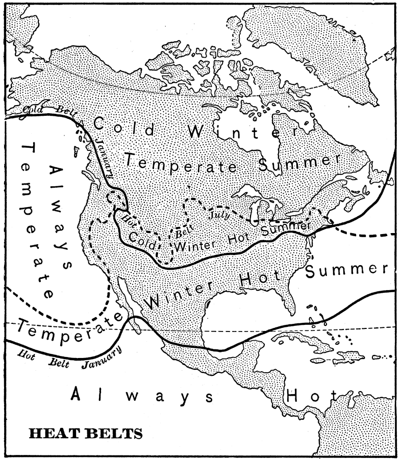
Description: A map from 1898 showing the heat belts in North America. The map gives the boundary isotherms of the hot belt as a mean temperature of 70° Fahrenheit and the cold belt as a mean temperature of 30° Fahrenheit, indicating the January hot belt in North America extending only to central Mexico and the July hot belt (dashed line) extending into Canada, while the January cold belt extends to the central states. The map shows the effect of land mass and elevation on temperatures, and the modifying effects of coastal areas. "The central part of the west coast is always temperate, because the prevailing westerlies, which have the nearly uniform temperature of the Pacific Ocean, warm the coast in winter and cool it in summer. By the time the winds reach the eastern coast they have acquired the temperature of the land over which they have traveled; hence the east coast is colder in winter and hotter in summer than the west coast." — Redway, 1898.
Place Names: A Complete Map of North America, Bahamas, �Canada, �Cuba, �Mexico, �United States, �Hot Belt Januar
ISO Topic Categories: climatologyMeteorologyAtmosphere
Keywords: Heat Belts in North America, meteorological, �historical, kClimate, climate, climatologyMeteorologyAtmosphere, Unknown,1898
Source: Jacques W. Redway and Russell Hinman, Natural Advanced Geography (New York, NY: American Book Company , 1898) 46
Map Credit: Courtesy the private collection of Roy Winkelman |
|