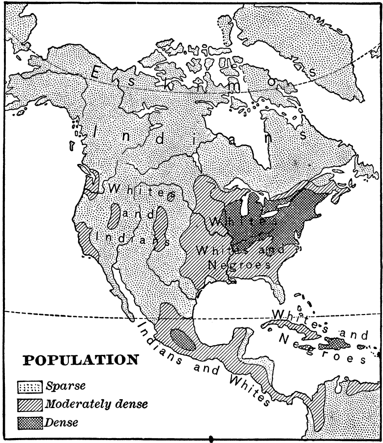
Description: A map from 1898 showing the population distribution of North America, Central America, and Caribbean to Puerto Rico. The map shows areas of sparse to heavily populated concentrations at the time. "Many thousands of white men from western and central Europe have come across the Atlantic Ocean to seek homes in the United States and in Canada...The Indians have been gradually driven westward and northward into the drier and colder and hence less desirable parts of the grand division by the ever-advancing tide of ...white settlers...There were always many more Indians in Mexico and Central America than in the wider part of the grand division further north, and not nearly so many white men have settled in these countries." —Redway, 1898.
Place Names: A Complete Map of North America, Bahamas, �Canada, �Cuba, �Mexico, �United State
ISO Topic Categories: society
Keywords: Population of North America, statistical, �historical, kPopulation, population, society, Unknown,1898
Source: Jacques W. Redway and Russell Hinman, Natural Advanced Geography (New York, NY: American Book Company , 1898) 49
Map Credit: Courtesy the private collection of Roy Winkelman |
|