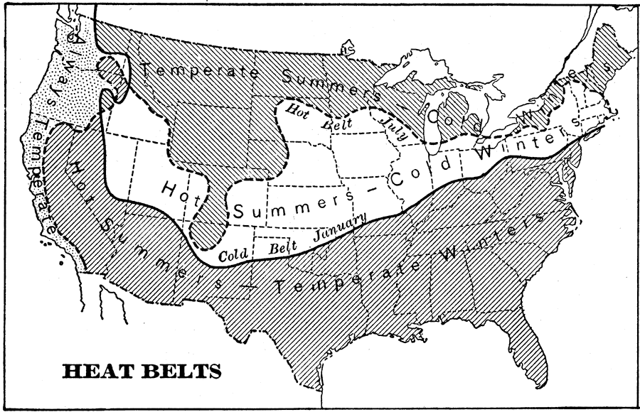
Description: A map from 1898 showing the heat belts in North America. "The north temperate heat belt travels northward in summer and southward in winter...In summer it [the heat belt] is so far north that its southern edge occupies the position represented by the dotted line in the...chart...All the country south of this line is in the hot belt at that season. In winter, however, the edge of the hot belt is in Mexico, and the temperate belt covers only the southern part of the United States, while all the country north of the heavy line in the chart is in the cold belt." —Redway, 1898.
Place Names: Meteorology,
ISO Topic Categories: climatologyMeteorologyAtmosphere
Keywords: Heat Belts in the United States, meteorological, �historical, kClimate, climate, climatologyMeteorologyAtmosphere, Unknown,1898
Source: Jacques W. Redway and Russell Hinman, Natural Advanced Geography (New York, NY: American Book Company , 1898) 54
Map Credit: Courtesy the private collection of Roy Winkelman |
|