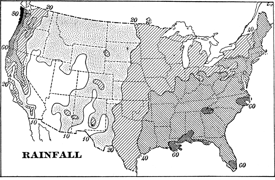
Description: A map from 1898 of the United States showing the general annual rainfall distribution. "The regions shaded by lines would each year be covered more than twenty inches deep by the rainfall, if the water remained where it fell. This amount is ample for almost all kinds of farming. In the parts of the United States shown by dots, or left unshaded, the rainfall is less than twenty inches and is too little for successful farming, except in some parts of the north where the rains occur during the few weeks when the growing crops need most moisture. As a rule, however, irrigation is necessary for farming in these regions of light rainfall." —Redway, 1898.
Place Names: Meteorology, rainfal
ISO Topic Categories: climatologyMeteorologyAtmosphere
Keywords: Rainfall in the United States, historical, �meteorological, kClimate, kPrecipitation, rainfall, climatologyMeteorologyAtmosphere, Unknown,1898
Source: Jacques W. Redway and Russell Hinman, Natural Advanced Geography (New York, NY: American Book Company , 1898) 54
Map Credit: Courtesy the private collection of Roy Winkelman |
|