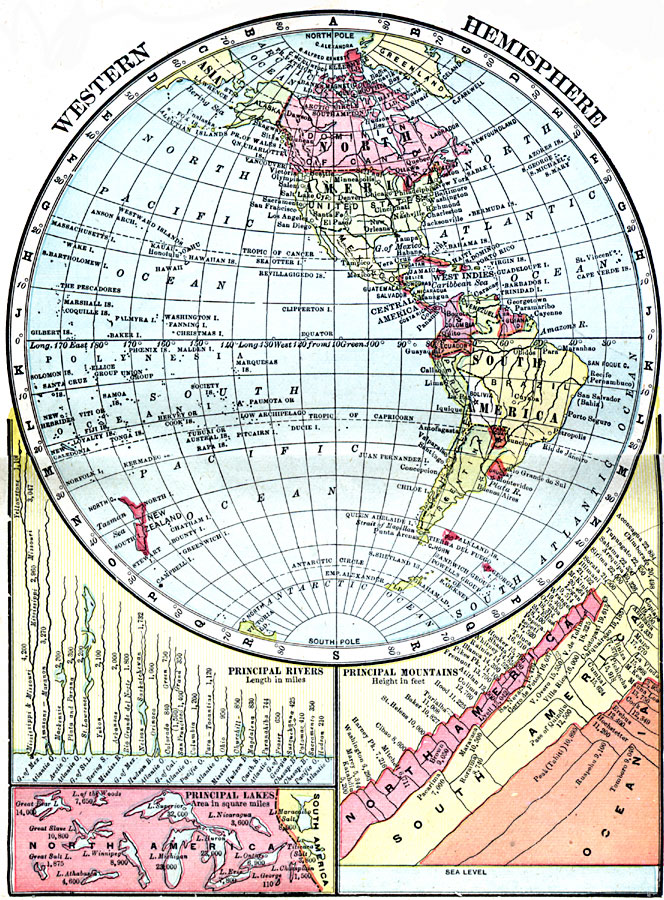
Description: A map of the Western Hemisphere from 1906 showing the continents and country borders of the time, including capital cities. This map has inset charts showing the principal rivers and their lengths given in miles, principal lakes in North and South America with their area given in square miles, and principal mountains with elevations in feet above sea level and their locations color–coded as Oceania in orange, South America in yellow, and North America in pink.
Place Names: Western Hemisphere, North America, �South Americ
ISO Topic Categories: boundaries,
inlandWaters,
location,
oceans
Keywords: Western Hemisphere, physical, �topographical, �geological, �political, �borders, �boundaries, �physical features,
topographical, country borders, boundaries,
inlandWaters,
location,
oceans, Unknown, 1906
Source: George F. Cram , Cram's Quick Reference Atlas and Gazetteer of the World (Chicago , Illinois : George F. Cram Series of Atlases, 1906) 5
Map Credit: Courtesy the private collection of Roy Winkelman |
|