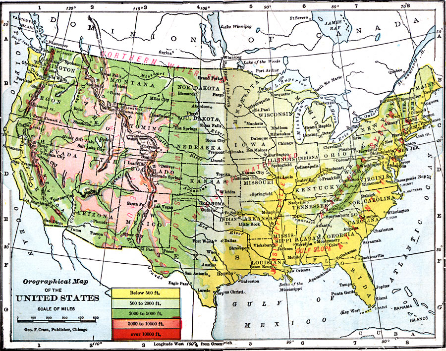
Description: An orographical map from 1906 of the United States showing terrain features including mountain systems, plateaus and slopes, watersheds, lakes, and rivers. The map is color–coded to show land elevations from sea level to over 10,000 feet.
Place Names: A Complete Map of the United States, Boston, �Chicago, �Houston, �Los Angeles, �Miami, �New Orleans, �New York, �San Diego, �Seattle, �Washington D.C
ISO Topic Categories: boundaries,
inlandWaters,
location,
oceans,
elevation
Keywords: Orographical Map of the United States, physical, �orographical, �political, �borders, �boundaries, kOrographic, physical features, country borders, boundaries,
inlandWaters,
location,
oceans,
elevation, Unknown, 1906
Source: George F. Cram , Cram's Quick Reference Atlas and Gazetteer of the World (Chicago , IL: George F. Cram Series of Atlases, 1906) 9
Map Credit: Courtesy the private collection of Roy Winkelman |
|