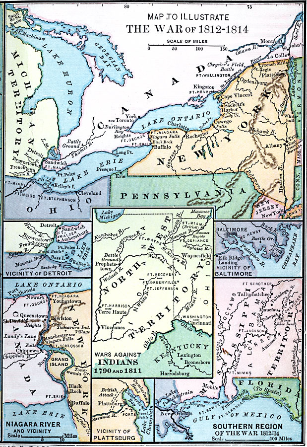
Description: A series of maps showing the principal regions, campaigns, forts, and battle sites of the War of 1812, including: the northern seat of war in southern Canada, New York, Pennsylvania, Ohio, and the Michigan Territory; the vicinity of Detroit; the vicinity of Baltimore; the Niagara River and vicinity; the vicinity of Plattsburg on Lake Champlain; the southern seat of the war in the Mississippi Territory, Florida, and New Orleans area; and the area of the Northwest Indian Wars (1790 and 1811).
Place Names: Growth of Nation, New York, �Baltimore, �Detroit, �Cleveland, �War of 181
ISO Topic Categories: boundaries,
intelligenceMilitary,
location,
inlandWaters,
oceans
Keywords: The War of 1812, physical, �political, �historical, �war of 1812, physical features, country borders,
major political subdivisions, other military, boundaries,
intelligenceMilitary,
location,
inlandWaters,
oceans, Unknown, 1812–1814
Source: Joel Dorman Steele, A Brief History of the United States (New York, NY: American Book Company, 1885) 148
Map Credit: Courtesy the private collection of Roy Winkelman |
|