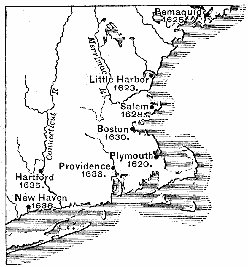
Description: A map of the New England colonies showing the early permanent Pilgrim settlements and their dates of establishment, including Plymouth (1620), Little Harbor, New Hampshire (1623), Pemaquid, Maine (1625), Salem, Massachusetts (1628), Boston (1630), Providence, Rhode Island (1636), Hartford, Connecticut (1635), and New Haven, Connecticut (1638).
Place Names: Early America 1400-1800, Boston, �Little Harbor, �Boston, �Salem, �Plymouth, �Providence, �Hartford, �New Haven, �Colonial America, �New Englan
ISO Topic Categories: inlandWaters,
location,
oceans
Keywords: New England Colonies, physical, �political, physical features, local jurisdictions, inlandWaters,
location,
oceans, Unknown, 1620–1638
Source: Edward Eggleston, The Household History of the United States and Its People (New York, NY: D. Appleton and Company, 1898) 47
Map Credit: Courtesy the private collection of Roy Winkelman |
|