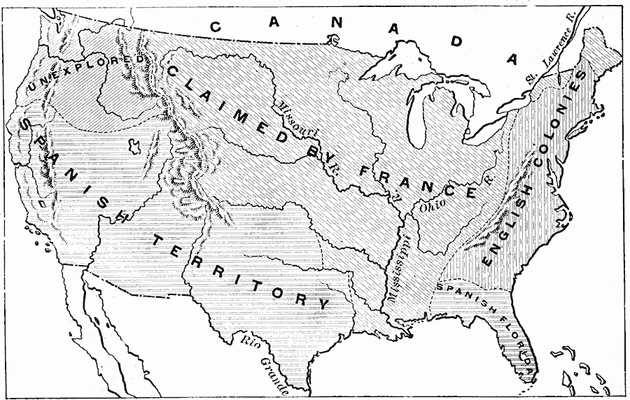
Description: A map of the present day territory of the United States, showing the European claims to the land before 1763 and the end of the French and Indian Wars. The map shows the claims of the British, French, and Spanish, and shows the unexplored territory of Oregon Country.
Place Names: Early America 1400-1800, French and Indian War, �Treaty of Pari
ISO Topic Categories: inlandWaters,
location,
oceans,
boundaries
Keywords: Old Claims in the Present Territory of the United States, physical, �political, physical features, major political subdivisions, inlandWaters,
location,
oceans,
boundaries, Unknown, 1763
Source: Edward Eggleston, The Household History of the United States and Its People (New York, NY: D. Appleton and Company, 1898) 119
Map Credit: Courtesy the private collection of Roy Winkelman |
|