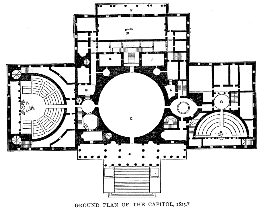
Description: A plan of the ground floor of the Capitol Building from 1825. The map is keyed to show: (A) House of Representatives, 96 feet radius; (B) Senate Chamber, 75 feet radius; (C) Central Rotunda, 96 feet in diameter; (D) Library, 92 x 34 feet; (E) Eastern Portico; (F) Western Portico; and (G) open areas. The eastern front is 350 feet long.
Place Names: District of Columbia, Washington D.C., �The Capito
ISO Topic Categories: structure
Keywords: Ground Plan of the Capitol, physical, �building plans, �U.S. capital, �historical, physical features, structure, Unknown,1825
Source: Justin Winsor, Narrative and Critical History of North America Vol. VII (Boston, MA: Houghton, Mifflin and Company, 1888) 347
Map Credit: Courtesy the private collection of Roy Winkelman |
|