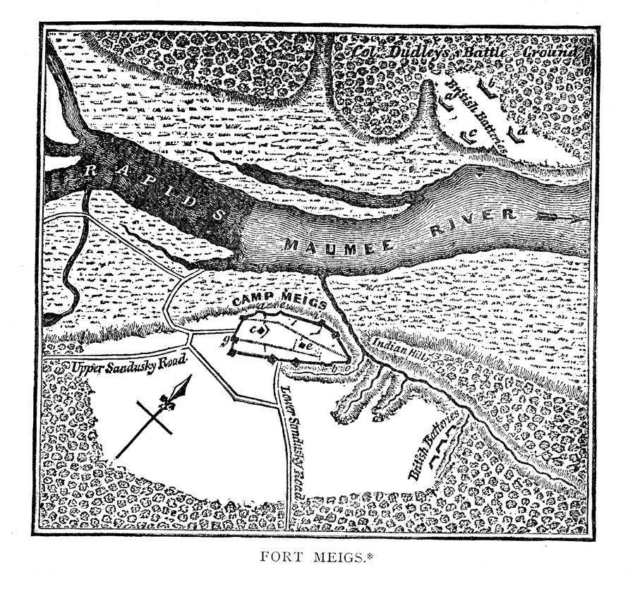
Description: Fort Meigs was the site of the first British setback during the War of 1812. The British had taken Forts Detroit, Mackinac, and Dearborn. Only Fort Wayne in Indiana territory was able to defend itself. Fort Meigs defended itself for nine days under the leadership of General William Henry Harrison in May 1813 that ended up turning the tide of the war.
Place Names: Ohio, Ohio, �Maumee River, �Perrysburg, �Fort Meigs,
ISO Topic Categories: boundaries,
inlandWaters,
society
Keywords: Fort Meigs, physical, �political, �transportation, �historical, �War of 1812, �forts, �physical features, local jurisdictions, water routes,
roads, other military, boundaries,
inlandWaters,
society, Unknown,1813
Source: Justin Winsor, Narrative and Critical History of North America Vol. VII (Boston, MA: Houghton, Mifflin and Company, 1888) 430
Map Credit: Courtesy the private collection of Roy Winkelman |
|