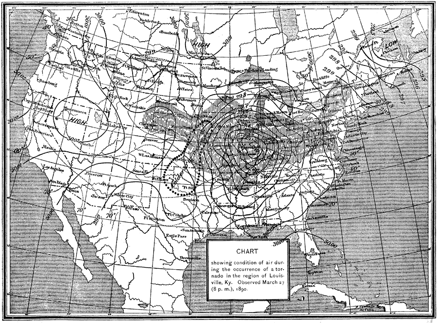
Description: A map from 1891 showing atmospheric conditions during a tornado in Kentucky on March 27, 1890.
Place Names: Meteorology, Boston, �Chicago, �Houston, �Los Angeles, �Miami, �New Orleans, �New York, �San Diego, �Seattle, �Washington D.C
ISO Topic Categories: boundaries,
climatologyMeteorologyAtmosphere,
inlandWaters
Keywords: Weather Chart, physical, �meteorological, �political, �barometric pressure, �atmospheric pressure, �tornadoes, kClimate, physical features, country borders,
major political subdivisions, climate, boundaries,
climatologyMeteorologyAtmosphere,
inlandWaters, Unknown,March 27, 1890
Source: , Report of the Secretary of Agriculturre - 1891 (Washington, DC: Government Printing Office, 1892) 550
Map Credit: Courtesy the private collection of Roy Winkelman |
|