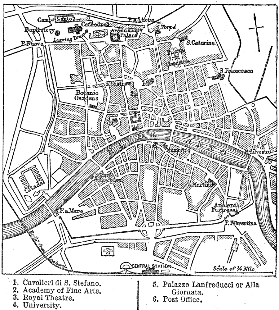
Description: A city plan of Pisa, Italy, in 1903, showing major streets, railway station, the River Arno (and bridges), and several historic landmarks of the city. "Pisa, which has always been one of the most important cities of central Italy, is situated on the banks of the Arno at a short distance from the sea, in the midst of a fertile plain backed by the marble mountains wooded with pines and other forest trees. In the days of Strabo it was only two geographical miles from the sea–shore, but the continual increase of the delta at the mouth of the river has now trebled that distance. In the Middle Ages the Arno was still navigable for all ships of war then in use, and formed the safest of harbours." (— Kellogg, 1903)
Place Names: Italy, Pisa, �River Arno,
ISO Topic Categories: boundaries,
inlandWaters
Keywords: Pisa, physical, �political, physical features, local jurisdictions, boundaries,
inlandWaters, Unknown,1903
Source: Day Otis Kellogg, D.D., Encyclopedia Britannica Vol. XIX (New York, NY: The Werner Company, 1903) 118
Map Credit: Courtesy the private collection of Roy Winkelman |
|