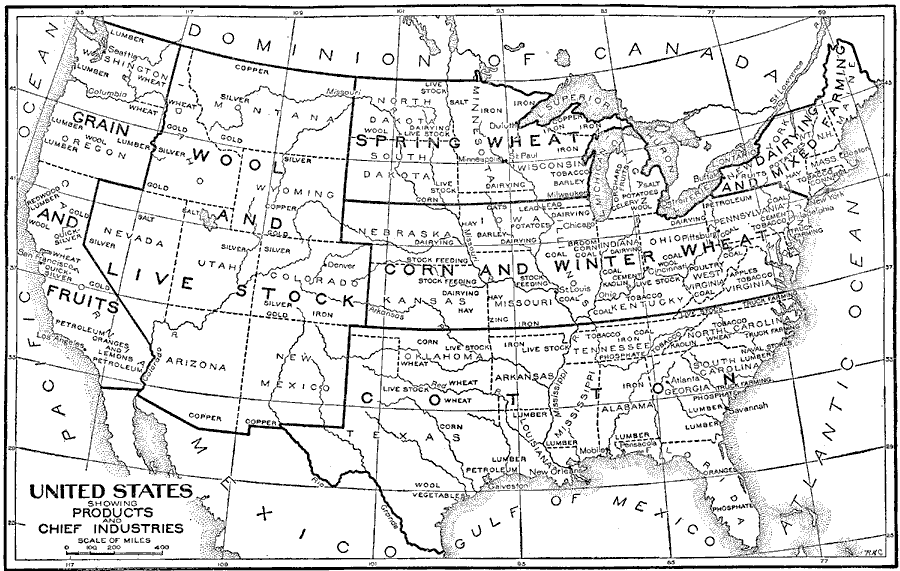
Description: A map from 1921 of the United States showing the principal agricultural and mineral regions. "The words in large type indicate the chief crop or industry in each region. Those in smaller type indicate other products and industries. The great agricultural regions are the prairies of the Mississippi Basin, east of the 100th meridian; the land bordering on the Gulf of Mexico, and the valleys of the Pacific slope. The Appalachian region is not so fertile as the others. The arid region, including the states within the Rocky Mountain plateau and the southern part of California, embraces nearly one third of the country." — Foster, 1921.
Place Names: Industry, Boston, �Chicago, �Los Angeles, �New York, �Missouri River,�Mississippi River, �Lake Superior,�Lake Huron, �Lake Michigan, �Lake Erie, �Lake Ontar
ISO Topic Categories: farming
Keywords: United States Showing Products and Chief Industries, statistical, �physical, kAgriculture, physical features, agriculture, farming, Unknown,1921
Source: Ellsworth D. Foster, ed., The American Educator Vol. 8 (Chicago, IL: Ralph Durham Company, 1921) 3683
Map Credit: Courtesy the private collection of Roy Winkelman |
|