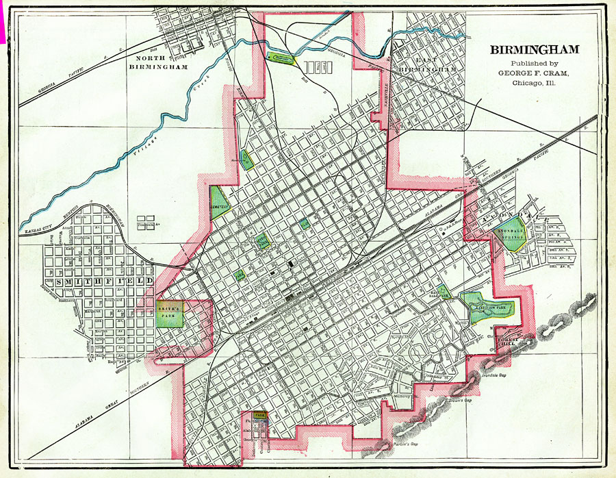
Description: A map of Birmingham, Alabama from 1886 showing the city limits at the time, the outlying neighborhoods of Smithfield, Avondale, East Birmingham, and North Birmingham, streets and street names, Union train depot and rail routes, the county courthouse and other government buildings, city parks, and cemeteries.
Place Names: Alabama, Birmingha
ISO Topic Categories: boundaries,
transportation
Keywords: Birmingham, Alabama, political, �transportation, �L. P. Grant Park, �Oakland Cemetery, �physical, physical features, local jurisdictions, roads,
railroads, boundaries,
transportation, Unknown,1886
Source: George F. Cram, (Chicago, IL: Geo. F. Cram, 1886) 176
Map Credit: Courtesy the private collection of Roy Winkelman |
|