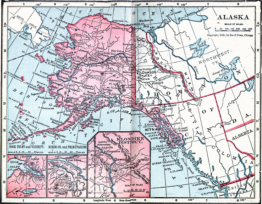
Description: A map of Alaska from 1906 showing the State capital at Sitka, cities, towns, ports, major rivers and mountains, coastal features, and islands. The map has inset maps detailing the areas around Dawson in the Klondike District, Fort Yukon on the Yukon River, and Hope City on the Cook Inlet.
Place Names: Alaska, Anchorage, �Cordova, �Fairbanks, �Juneau, �Kenai, �Kodiak, �Nome, �Palmer, �Sitka, �Skagwa
ISO Topic Categories: boundaries,
inlandWaters,
location,
oceans
Keywords: Alaska, physical, �political, �borders, �boundaries, �physical features, country borders, boundaries,
inlandWaters,
location,
oceans, Unknown, 1906
Source: George F. Cram , Cram's Quick Reference Atlas and Gazetteer of the World (Chicago , IL: George F. Cram Series of Atlases, 1906) 57
Map Credit: Courtesy the private collection of Roy Winkelman |
|