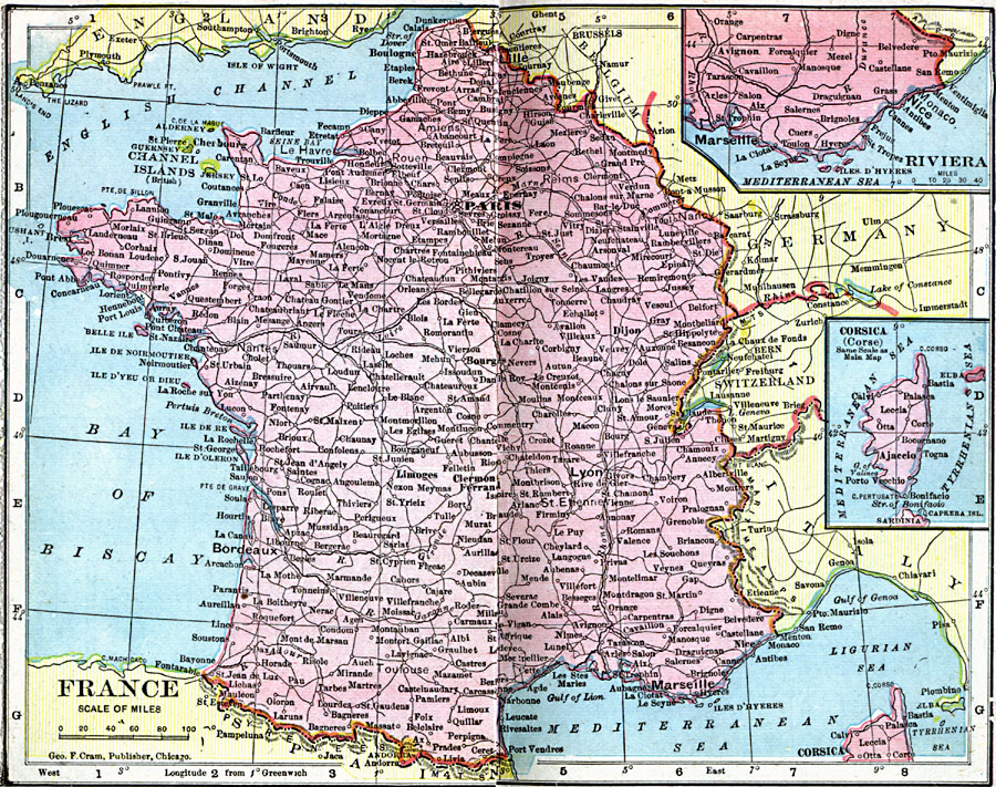
Description: A map of France in 1906, showing major cities and towns, railways, rivers, and inset maps of the Riviera near Marseille and the island of Corsica.
Place Names: France, Bordeaux, �Dunkerque, �Grenoble, �Lyon, �Nancy, �Nice, �Orleans, �Paris, �Starsbourg, �Tour
ISO Topic Categories: boundaries,
inlandWaters,
location,
oceans
Keywords: France, physical, �political, �borders, �boundaries, �physical features, country borders, boundaries,
inlandWaters,
location,
oceans, Unknown, 1906
Source: George F. Cram , Cram's Quick Reference Atlas and Gazetteer of the World (Chicago , Illinois : George F. Cram Series of Atlases, 1906) 78
Map Credit: Courtesy the private collection of Roy Winkelman |
|