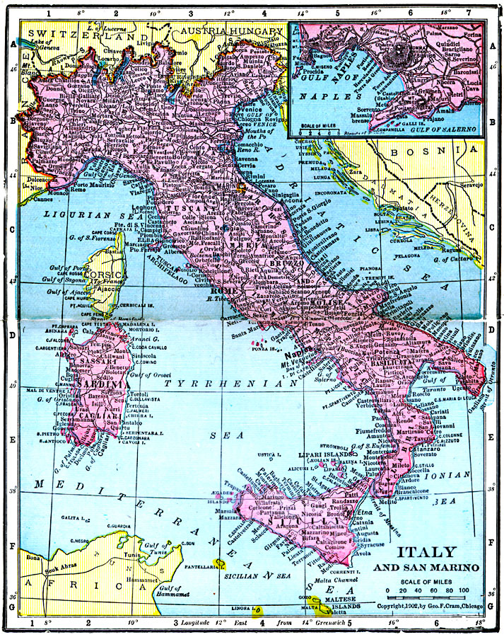
Description: A map from 1906 of Italy, San Marino, and the islands of Corsica, Sardinia, and Sicily. The map shows provinces, principal cities and towns, railroads, mountains, rivers, and coastal features. An inset map details the Bay of Naples.
Place Names: Italy, Italy, �San Marin
ISO Topic Categories: boundaries,
inlandWaters,
location,
oceans
Keywords: Italy and San Marino, physical, �political, �borders, �boundaries, �physical features, country borders, boundaries,
inlandWaters,
location,
oceans, Unknown, 1906
Source: George F. Cram , Cram's Quick Reference Atlas and Gazetteer of the World (Chicago , IL: George F. Cram Series of Atlases, 1906) 80
Map Credit: Courtesy the private collection of Roy Winkelman |
|