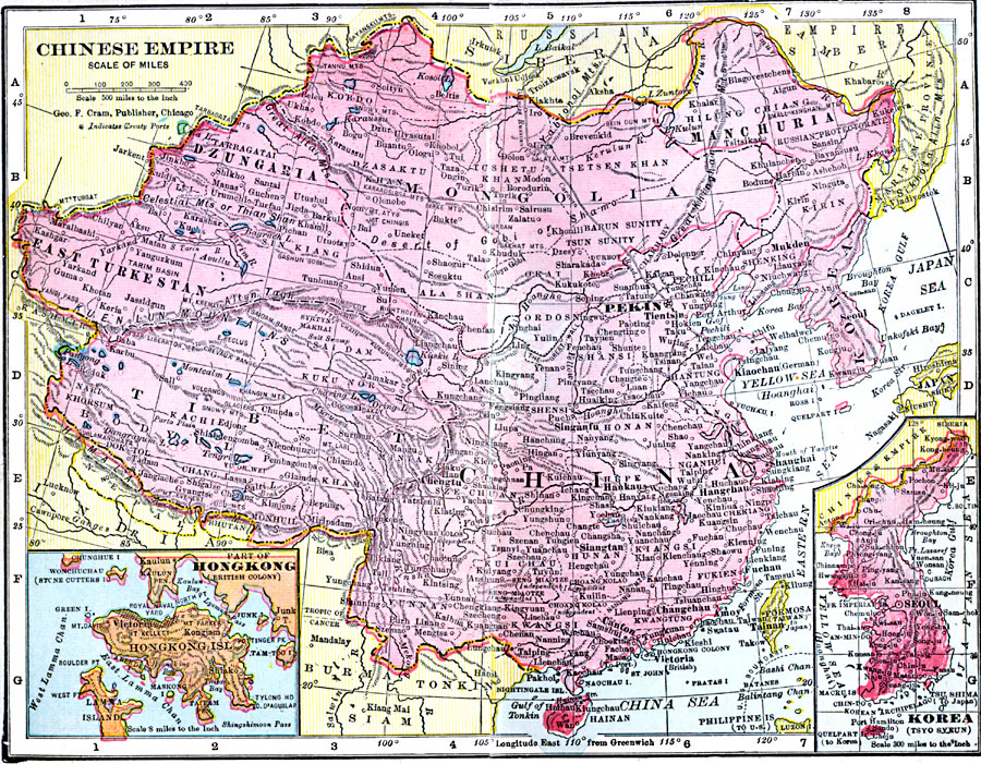
Description: A map from 1906 of the Chinese Empire, showing the political boundaries of the time, major cities, treaty ports, foreign possessions, railroads, terrain, lakes, rivers, and coastal features. Two inset maps detail the Korean Peninsula, and the British colony of Hong Kong Island.
Place Names: China, Beijing, �Chengdu, �Lanzhou, �Lhasa, �Nanjing, �Peking, �Shanghai, �Shenyang, �Urumqi, �Wuhan, �Zhengzo
ISO Topic Categories: boundaries,
inlandWaters,
location,
oceans
Keywords: Chinese Empire, physical, �political, �borders, �boundaries, �physical features, country borders, boundaries,
inlandWaters,
location,
oceans, Unknown, 1906
Source: George F. Cram , Cram's Quick Reference Atlas and Gazetteer of the World (Chicago , IL: George F. Cram Series of Atlases, 1906) 96
Map Credit: Courtesy the private collection of Roy Winkelman |
|