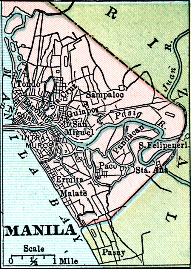
Description: A city plan of Manila, Philippines, in 1920. The map shows the municipal boundary with the province of Rizal at he time, major thoroughfares, the Pasig River, the old city walls around the Intramuros District, and the districts of Binondo (China Town), Ermita, Malate, Paco, Pandacan, Guiapo (Quiapo, or old downtown), Sampaloc, San Miguel, San Nicolas, Santa Ana, Santa Cruz, San Felipe Neri (Mandaluyong), and Tondo (Muslim District), and the neighboring city of Pasay, now part of Metro Manila.
Place Names: Philippines, Manila, �Guiapo, �Sampalo
ISO Topic Categories: boundaries,
inlandWaters,
location,
oceans,
transportation
Keywords: Manila, physical, �political, �transportation, physical features, local jurisdictions, roads, boundaries,
inlandWaters,
location,
oceans,
transportation, Unknown, 1920
Source: , Leslie's New World Atlas (New York City, NY: Leslie-Judge Company, 1920) 28
Map Credit: Courtesy the private collection of Roy Winkelman |
|