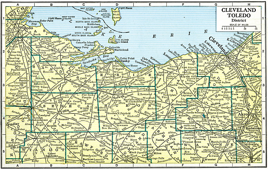
Description: A map from 1920 of the Cleveland Toledo district, showing counties and county seats, principal cities and towns, railroads, and islands of Lake Erie.
Place Names: Ohio, Cleveland, �Akron, �Toledo, �Lakewoo
ISO Topic Categories: boundaries,
location,
inlandWaters,
transportation
Keywords: Cleveland and Toledo District, physical, �political, �transportation, physical features, major political subdivisions,
county borders, railroads, boundaries,
location,
inlandWaters,
transportation, Unknown, 1920
Source: John C. Winston, Winston's New and Complete Atlas of the World (New York, NY: The John C. Winston Company, 1920) 98
Map Credit: Courtesy the private collection of Roy Winkelman |
|