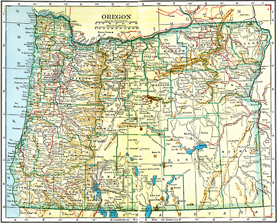
Description: A map from 1920 of Oregon showing the capital of Salem, counties and county seats, principal cities and towns, Indian reservations, railroads, mountain systems, lakes, rivers, and coastal features.
Place Names: Oregon, Astoria, �Albany, �Dalles, �Eugene City, �Oregon City, �Portland, �Roseburg, �Salem, �Umatilla, �Junction Cit
ISO Topic Categories: boundaries,
inlandWaters,
transportation,
location,
oceans
Keywords: Oregon, physical, �political, �transportation, kNativeAmerican, physical features, major political subdivisions,
county borders, railroads, boundaries,
inlandWaters,
transportation,
location,
oceans, Unknown, 1920
Source: John C. Winston, Winston's New and Complete Atlas of the World (New York, NY: The John C. Winston Company, 1920) 102
Map Credit: Courtesy the private collection of Roy Winkelman |
|