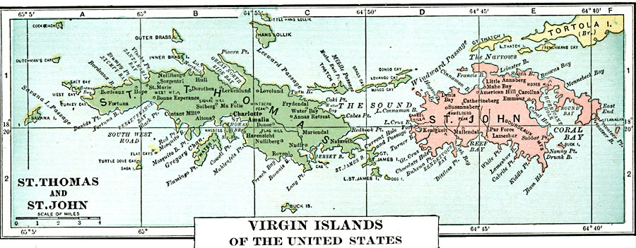
Description: A map from 1920 of the islands of St. Thomas and St. John showing towns and ports.
Place Names: Virgin Islands, Charlotte Amalia, �Contant Mill, �Altona, �Sorgentri, �Nulliberg, �Havensicht, �Nadir, �Annas Retreat, �Frydendal, �Nazareth, �Denis Bay, �Mallendal, �Par Force, �Lameshur, �Bourdeaux, �Catherineberg, �American Hill, �Maho Bay, �Annaberg, �Lovelund, �C
ISO Topic Categories: inlandWaters,
location,
oceans
Keywords: St. Thomas and St. John, physical, �political, kCaribbean, physical features, inlandWaters,
location,
oceans, Unknown, 1920
Source: , Leslie's New World Atlas (New York City, NY: Leslie-Judge Company, 1920) 37
Map Credit: Courtesy the private collection of Roy Winkelman |
|