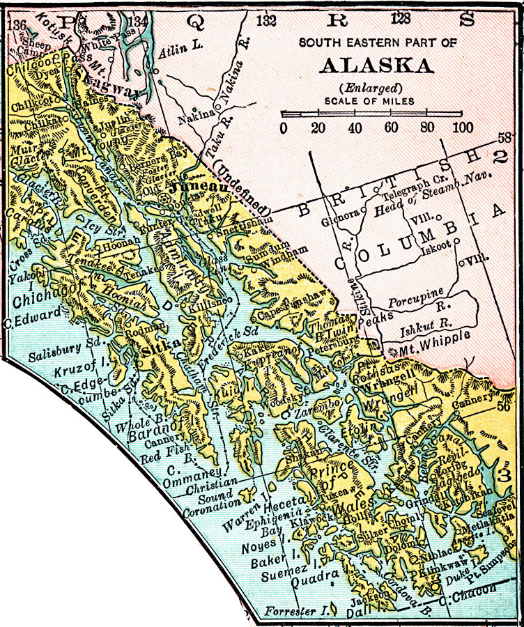
Description: A map of the southeastern part of Alaska from 1920 showing the State capital at Juneau, Sitka and other towns, submarine telegraph cables, rivers, islands, and fjords of the area, and the undefined border with Canada.
Place Names: Alaska, Sitka, �Juneau, �Skagway, �Klawock, �Wrangel
ISO Topic Categories: boundaries,
inlandWaters,
location,
oceans
Keywords: South Eastern Part of Alaska, physical, �political, physical features, country borders, boundaries,
inlandWaters,
location,
oceans, Unknown, 1920
Source: , Leslie's New World Atlas (New York City, NY: Leslie-Judge Company, 1920) 38
Map Credit: Courtesy the private collection of Roy Winkelman |
|