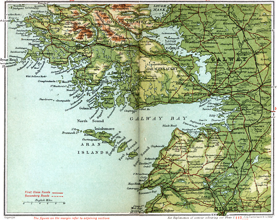
Description: A detailed travel map of Ireland in 1908, showing portions of counties Galway and Clare, with the western section of Connemara labeled "Joyces Country." The map shows first class and secondary roads, railways, cities, towns, ports, rivers, lakes, terrain, and coastal features of the area. This map uses contour–coloring to show terrain, with elevations shown in feet. Cities on this map include Tuam, Athenry, Gort, Ennis, Galway, Onghterard, and Clifden, with coastal Mannin Bay, Kilkieran Bay, Golam Head, Galway Bay, and Aran Islands, and inland Lough Corrib, Iar Connaught, Mamturk Mountains, Devilsmother, and The Twelve Pins.
Place Names: Ireland, Aran Islands, �Clare, �Galway, �Gort, �Iar Connaught, �Joyces Countr
ISO Topic Categories: inlandWaters,
location,
oceans,
transportation
Keywords: Galway and Connemara, roads, �transportation, roads, inlandWaters,
location,
oceans,
transportation, Unknown, 1908
Source: J.G. Bartholomew, F.R.G.S., The Handy Touring Atlas of the British Isles Specially Prepared for Cyclists, Motorists, and Travellers (London, United Kingdom : George Newnes, Limited, 1908) 108-109
Map Credit: Courtesy the private collection of Roy Winkelman |
|