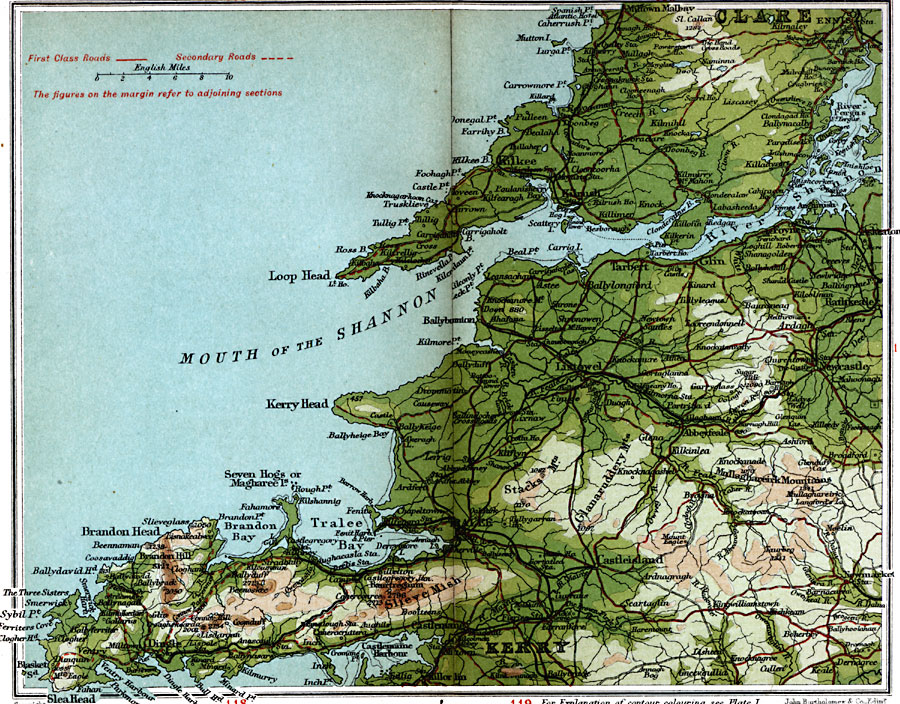
Description: A detailed travel map of Ireland in 1908, showing portions of counties Clare and Kerry. The map shows first class and secondary roads, railways, cities, towns, ports, rivers, lakes, terrain and coastal features of the area. This map uses contour–coloring to show terrain, with elevations shown in feet. Cities on this map include Ennis, Kilkee, Foynes, Rathkeale, Listowel, Newcastle, Castleisland, Tralee, Dingle, and Castlemane. Mountains and coastal features include Slieve Mish, Mullaghareirik Mountains, Mouth of the River Shannon, Loop Head, Kerry Head, Tralee Bay, Brandon Bay, Sybil Point, and Slea Head.
Place Names: Ireland, Brandon Head, �Castleisland, �Clare, �Dingle, �Kerry, �Kilkee, �Newcastle, �Trale
ISO Topic Categories: inlandWaters,
location,
oceans,
transportation
Keywords: Tralee and Kilkee, roads, �transportation, roads, inlandWaters,
location,
oceans,
transportation, Unknown, 1908
Source: J.G. Bartholomew, F.R.G.S., The Handy Touring Atlas of the British Isles Specially Prepared for Cyclists, Motorists, and Travellers (London, United Kingdom : George Newnes, Limited, 1908) 110-111
Map Credit: Courtesy the private collection of Roy Winkelman |
|