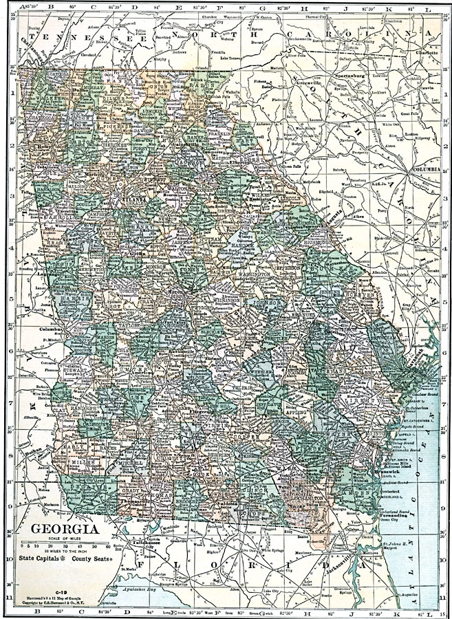
Description: A map from 1920 of Georgia showing the State capital of Atlanta, counties and county seats, major cities and towns, railroads, lakes, rivers, and the Atlantic coastline.
Place Names: Georgia, Albany, �Ashburn, �Fitzgerald, �Ocillia, �Douglas, �Valdosta, �Thomasville, �Wayeross, �Brunswick, �Fernandina, �Savannah, �Hawkinsville, �Americus, �Cordele, �Eastman, �Statesboro, �Macon, �Dublin, �Milledgeville, �Sandersville, �Griffin, �Atlanta, �D
ISO Topic Categories: boundaries,
inlandWaters,
location,
oceans,
transportation
Keywords: Georgia, physical, �political, �transportation, physical features, major political subdivisions,
county borders, roads,
railroads, boundaries,
inlandWaters,
location,
oceans,
transportation, Unknown, 1920
Source: , Leslie's New World Atlas (New York City, NY: Leslie-Judge Company, 1920) 55
Map Credit: Courtesy the private collection of Roy Winkelman |
|