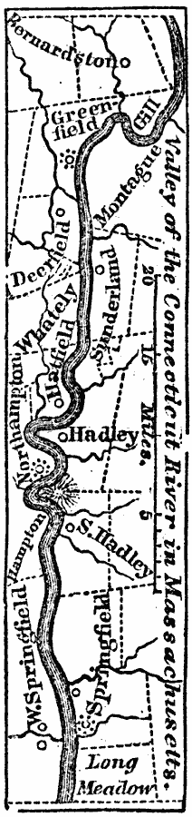
Description: A map from 1872 of the Connecticut River and Valley in Massachusetts from Bernardston and Greenfield south to Springfield and Long Meadow.
Place Names: Massachusetts, Springfield, �Deerfield, �Sunderland, �Hatfiel
ISO Topic Categories: location,
inlandWaters,
boundaries
Keywords: Connecticut River Valley, physical, �political, physical features, local jurisdictions, location,
inlandWaters,
boundaries, Unknown, 1872
Source: Marcius Willson, History of the United States (New York, NY: Ivison, Blakeman, Taylor, and Co., 1872) 87
Map Credit: Courtesy the private collection of Roy Winkelman |
|