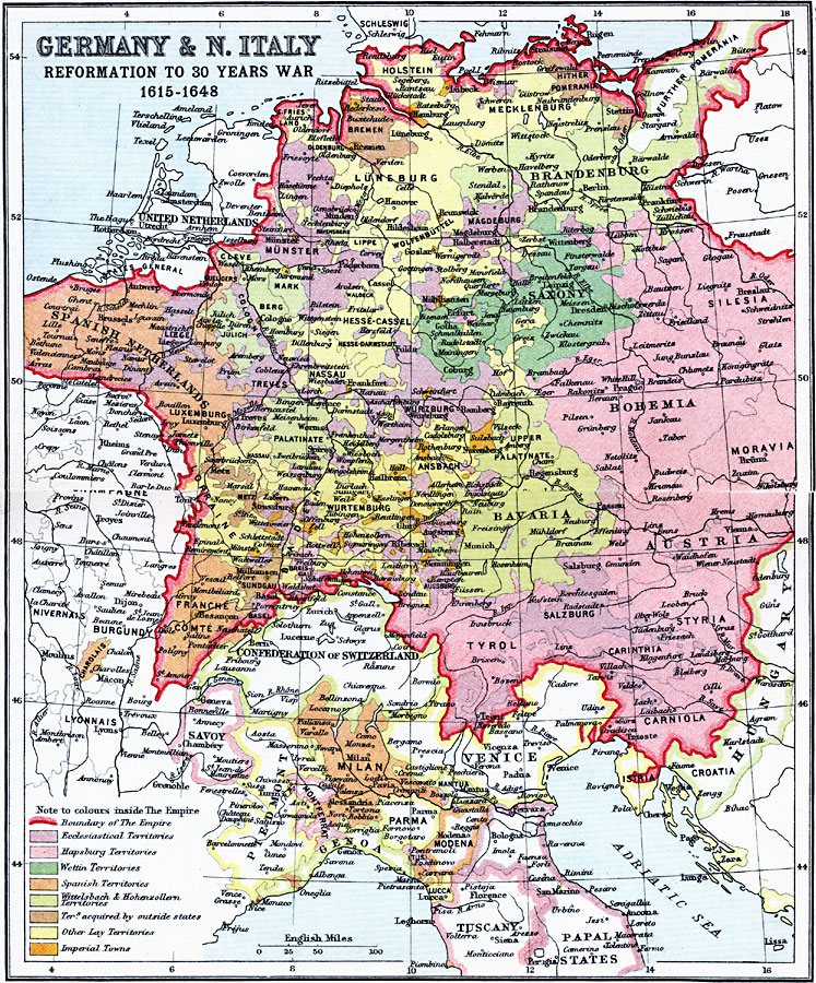
Description: A map detailing the various territories within Germany and northern Italy from 1615 during the Reformation to 1648 and the Peace of Westphalia at the end of the Thirty Years' War. This map highlights the German Empire at the time, and the numerous territories within the Empire and northern Italy, including the Ecclesiastical, Habsburg, Burgundian, Spanish, Wittelsbach, Wettin, and Hohenzollern territories, territories acquired by outside states, Imperial towns, and other "Lay" territories.
Place Names: Central Europe, Austria, �Bavaria, �Bohemia, �Brandenburg, �Champagne, �Germany, �Italy, �Luxemburg, �Saxony, �Wurtembur
ISO Topic Categories: inlandWaters,
location,
oceans
Keywords: Germany and Northern Italy - Reformation to 30 Years War, country borders, �political, kThirtyYearsWar, country borders, inlandWaters,
location,
oceans, Unknown, 1615–1648
Source: J.G. Bartholomew, LLD, A Literary & Historical Atlas of Europe (New York, NY: E.P. Dutton & Co., Ltd. , 1910) 36-37
Map Credit: Courtesy the private collection of Roy Winkelman |
|