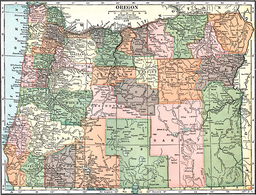
Description: A map from 1920 of Oregon showing the capital of Salem, counties and county seats, principal cities and towns, Crater Lake National Park, railroads, lakes, rivers, and coastal features.
Place Names: Oregon, Astoria, �Vancouver, �Portland, �Salem, �Eugene, �North Bend, �Roseburg, �Grants Pass, �Marshfield, �Medford, �Ashland, �The Dalles, �Lakeview, �Pendleton, �Dalle
ISO Topic Categories: boundaries,
inlandWaters,
location,
oceans,
transportation
Keywords: Oregon, physical, �political, �transportation, physical features, major political subdivisions,
county borders, roads,
railroads, boundaries,
inlandWaters,
location,
oceans,
transportation, Unknown, 1920
Source: , Leslie's New World Atlas (New York City, NY: Leslie-Judge Company, 1920) 100
Map Credit: Courtesy the private collection of Roy Winkelman |
|