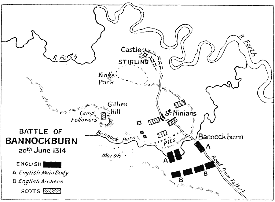
Description: Map shows the Battle of Bannockburn on 20th June, 1314, between Robert Bruce of Scotland and Edward II of England. The Scottish victory was a decisive point in the Wars of Scottish Independence.
Place Names: United Kingdom, Bannockburn, �England, �Gillies Hill, �King's Park, �Scotland, �Stirling,
ISO Topic Categories: inlandWaters,
location,
oceans
Keywords: Battle of Bannockburn, battle, �historical, �military, kBattle, historical event,
other military, inlandWaters,
location,
oceans, Unknown, June 20, 1314
Source: J.G. Bartholomew, LLD, A Literary & Historical Atlas of Europe (New York, New York: E.P. Dutton & Co., Ltd. , 1910) 121
Map Credit: Courtesy the private collection of Roy Winkelman |
|