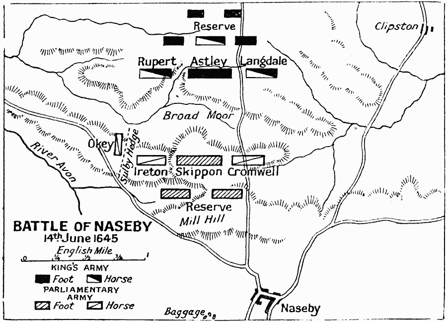
Description: A map of the Battle of Naseby in Northamptonshire, England, during the First English Civil War. The battle was between the Parliamentarian New Model Army under Fairfax and Cromwell, and the Royalist Army of King Charles I. This battle, fought on 14th June, 1645, resulted in a decisive defeat for the Royalists.
Place Names: United Kingdom, Clipston, �Cromwell, �England, �Ireton, �Langdale, �Naseby, �Okey, �Skippon, �United Kingdo
ISO Topic Categories: inlandWaters,
location,
oceans
Keywords: Battle of Naseby, battle, �historical, �military, kBattle, historical event,
other military, inlandWaters,
location,
oceans, Unknown, June 14, 1645
Source: J.G. Bartholomew, LLD, A Literary & Historical Atlas of Europe (New York, New York: E.P. Dutton & Co., Ltd. , 1910) 125
Map Credit: Courtesy the private collection of Roy Winkelman |
|