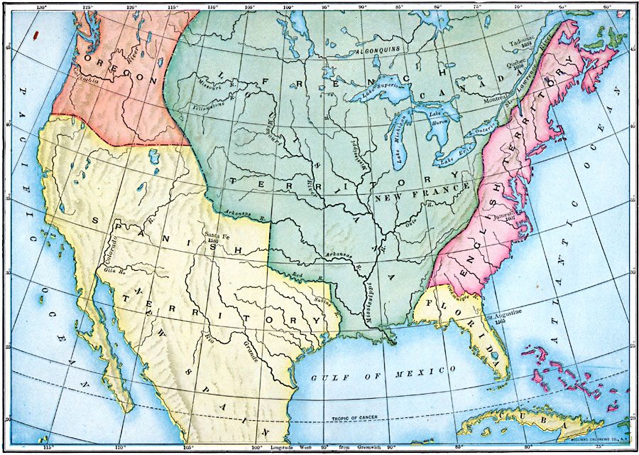
Description: A map of North America in 1760 showing the territorial claims at the time. The map is color–coded to show the claims of the French, English, and the Spanish. The Oregon Country is also shown, however this was a region unexplored by the Europeans at the time.
Place Names: Early America 1400-1800, St. Augustine, �Jamestown, �Santa Fe, �Spanish Territory, �French Territory, �British Territory, �New Franc
ISO Topic Categories: inlandWaters,
location,
oceans,
boundaries
Keywords: Claims in North America, physical, �political, physical features, major political subdivisions, inlandWaters,
location,
oceans,
boundaries, Unknown, 1760
Source: Ralph S. Tarr, B.S., F.G.S.A. and Frank M. McMurry, Ph.D., New Geographies 2nd ed (New York, NY: The Macmillan Company, 1910) 24
Map Credit: Courtesy the private collection of Roy Winkelman |
|