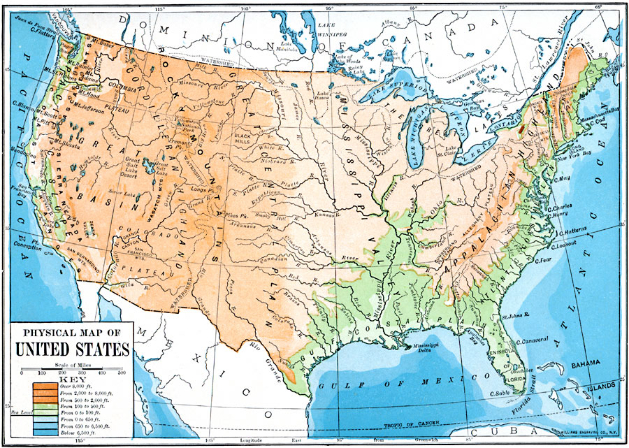
Description: A map from 1910 of the United States showing general elevations, water depths, watershed boundaries, and terrain features, including the Pacific Slope, Great Basin, Colorado Plateau, Cordilleran Highlands, Rocky Mountains, Great Central Plain, Mississippi Valley, Gulf Coastal Plain, Great Lakes, Appalachian Highlands, and the Atlantic Coastal Plain. The map is color–coded to show land elevations from sea level to over 8,000 feet, and water depths to over 6,500 feet, illustrating the submerged continental shelf and the submerged Florida platform.
Place Names: A Complete Map of the United States,
ISO Topic Categories: boundaries,
location,
oceans,
inlandWaters,
elevation
Keywords: The United States, political, �physical, physical features, country borders, boundaries,
location,
oceans,
inlandWaters,
elevation, Unknown, 1910
Source: Ralph S. Tarr, B.S., F.G.S.A. and Frank M. McMurry, Ph.D., New Geographies 2nd ed (New York, NY: The Macmillan Company, 1910) 27
Map Credit: Courtesy the private collection of Roy Winkelman |
|