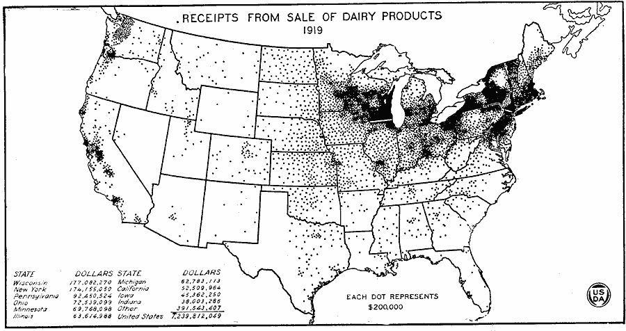
Description: A map of the United States from the U. S. Department of Agriculture (1922) showing the receipts from the sale of dairy products in 1919 by state.
Place Names: Agriculture, Wisconsin, New York, Pennsylvania, Ohio, Minnesota, Illinois, Michigan, California, Iowa, Indiana, �dairy product
ISO Topic Categories: farming,
boundaries,
inlandWaters,
economy
Keywords: Receipts from the Sale of Dairy Products, physical, �political, �statistical, �receipts from sale of dairy products by state in 1919 in dollars, kAgriculture, physical features, country borders,
major political subdivisions, agriculture,
economic, farming,
boundaries,
inlandWaters,
economy, Unknown, 1919
Source: , United States Department of Agriculture Yearbook 1922 (Washington, DC: Government Printing Office, 1923) 318
Map Credit: Courtesy the private collection of Roy Winkelman |
|