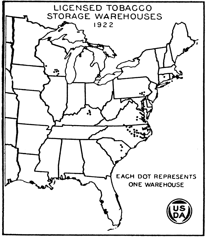
Description: A map of the eastern United States from the U. S. Department of Agriculture (1922) showing the number of licensed tobacco storage warehouses at the time. Each dot represents one warehouse.
Place Names: Agriculture, tobacc
ISO Topic Categories: boundaries,
oceans,
farming,
inlandWaters
Keywords: Licensed Tobacco Storage Warehouses, physical, �political, �statistical, �licensed tobacco storage warehouses in 1922, kAgriculture, physical features, major political subdivisions,
country borders, agriculture, boundaries,
oceans,
farming,
inlandWaters, Unknown, 1922
Source: , United States Department of Agriculture Yearbook 1922 (Washington, DC: Government Printing Office, 1923) 448
Map Credit: Courtesy the private collection of Roy Winkelman |
|