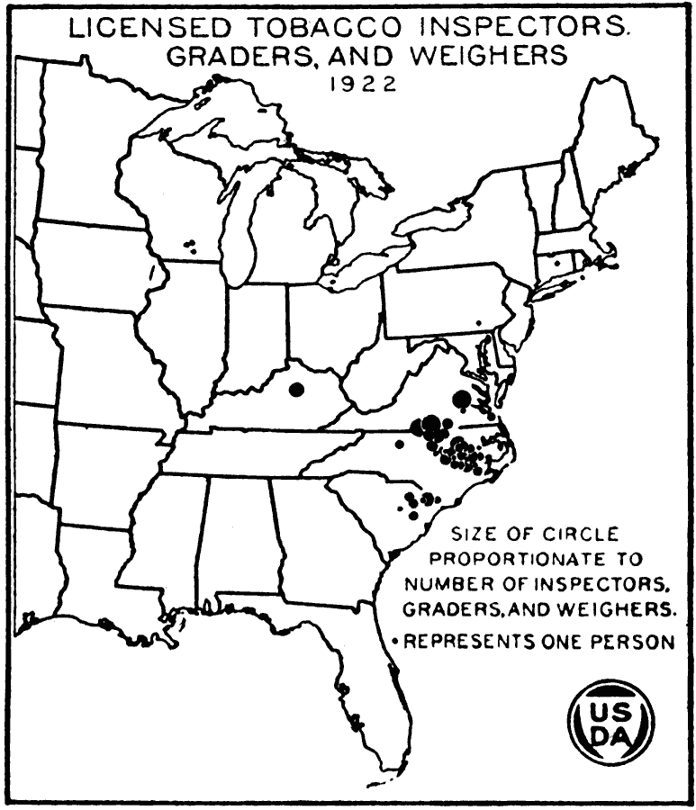
Description: A map of the eastern United States from the U. S. Department of Agriculture (1922) showing the number of licensed tobacco inspectors, graders and weighers at the time. The size of the circles is proportionate to the number of inspectors, graders and weighers in the area, with small dots representing one person.
Place Names: Agriculture, tobacc
ISO Topic Categories: boundaries,
oceans,
farming,
inlandWaters
Keywords: Licensed Tobacco Inspectors, Graders, and Weighers, physical, �political, �statistical, �licensed tobacco inspectors weighers graders 1922, kAgriculture, physical features, major political subdivisions,
country borders, agriculture, boundaries,
oceans,
farming,
inlandWaters, Unknown, 1922
Source: , United States Department of Agriculture Yearbook 1922 (Washington, DC: Government Printing Office, 1923) 448
Map Credit: Courtesy the private collection of Roy Winkelman |
|