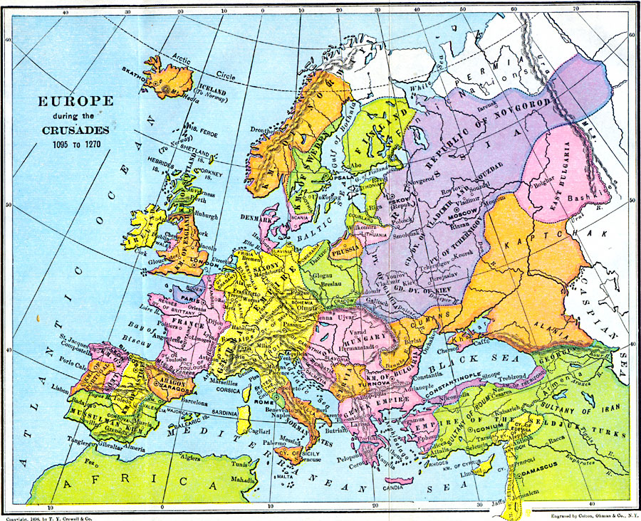
Description: A Map of Europe during the Crusades period showing the various lands and kingdoms including the German Empire, France, Kingdoms of Norway and Sweden, Republic of Novgorod, Kaptchak, Prussia, Saxony, Kingdom of Austria, Lombardia, the Norman States, Aragon, Kingdom of Castile, Mussulman Kingdom, Kingdom of Leon, Kingdom of England, and others in Europe as well as Middle Eastern lands such as the Empire of the Seldjuk, Sultany of Roum, the Kingdom of Cyprus, and the Kingdom of Jerusalem. The map also shows major cities of the period in both Europe and the Middle East.
Place Names: A Complete Map of Europe, Bulgaria, �France, �Germany, �Greece, �Hungary, �Ireland, �Italy, �Poland, �Portugal, �Prussia, �Romania, �Spain, �Sweden, �United Kingdo
ISO Topic Categories: location,
transportation
Keywords: Europe During the Crusades, country borders, �historical, �political, kCrusades, country borders, water routes, location,
transportation, Unknown, 1095–1270
Source: Victor Duruy, Edwin A. Grosvenor, & Louis E. Van Norman, Duruy's General History of the World (vol. II) (New York, New York: The Review of Reviews Company, 1912)
Map Credit: Courtesy the private collection of Roy Winkelman |
|