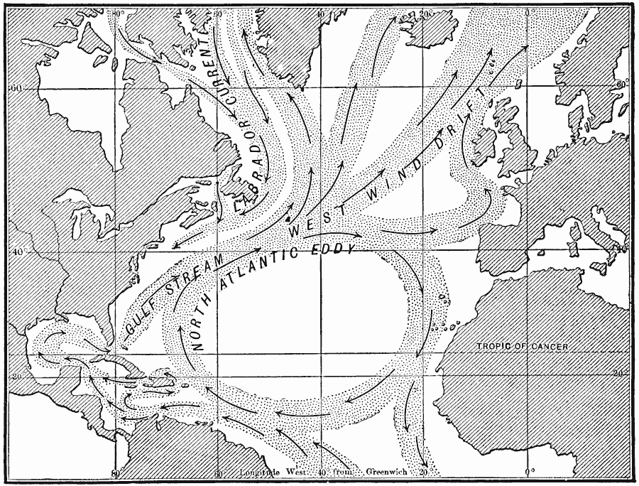
Description: A map of the North Atlantic Basin from 1910, a diagram to show the currents of the North Atlantic. In order to illustrate the currents clearly it has seemed necessary to make them as if they were sharply bounded, like a river in its channel. However, the boundaries of these great currents and drifts are so indefinite that one would not be able to detect the boundaries. This map shows the general directional flow of the Labrador Current, West Wind Drift, Gulf Stream, and the North Atlantic Eddy.
Place Names: Regional Atlantic Ocean, Africa, �North America, �South America, �Europ
ISO Topic Categories: physical, �hydrological, kOceanCurrents, kWorldAtlantic
Keywords: Currents of the North Atlantic, physical, �hydrological, kOceanCurrents, physical features, currents, physical, �hydrological, kOceanCurrents, kWorldAtlantic, Unknown, 1910
Source: Ralph S. Tarr, B.S., F.G.S.A. and Frank M. McMurry, Ph.D., New Geographies 2nd ed (New York, NY: The Macmillan Company, 1910) 221
Map Credit: Courtesy the private collection of Roy Winkelman |
|