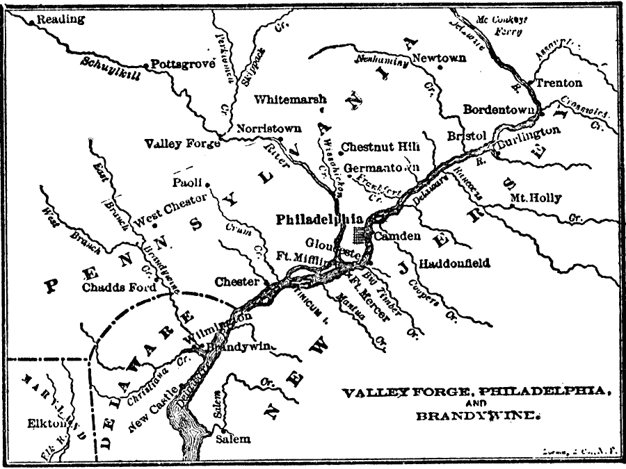
Description: A map of the area around Valley Forge and Philadelphia (the first capital, 1774–1800), site of several important operations during the American Revolution, including Washington's crossing of the Delaware near Trenton (1776), Wilmington, the British landing site under Howe at the Elk River (1777), the American defensive position at Chadd's Ford on the Brandywine River, retreat to Westchester and Philadelphia, the battle site near Paoli, the crossing of Schuylkill River at Norristown by Howe on his march to Philadelphia, the British encampment at Germantown, Fort Mercer, Fort Mifflin, and Valley Forge on the right bank of the Schuylkill, the winter quarters of Washington (1777–1778).
Place Names: Early America 1400-1800, Brandywine, �Delaware, �New Jersey, �Pennsylvania,�Philadelphia, �Valley Forge, ��American Revolutio
ISO Topic Categories: location,
oceans,
inlandWaters
Keywords: Valley Forge, Philadelphia, and Brandywine, American Revolution, �historical, �political, kAmericanRevolution, American Revolution,
historical event, location,
oceans,
inlandWaters, Unknown, 1776–1778
Source: John Clark Ridpath , History of the United States from Aboriginal Times to Taft's Administration (vol. 2) (New York, NY: The Review of Reviews Company, 1911) 367
Map Credit: Courtesy the private collection of Roy Winkelman |
|