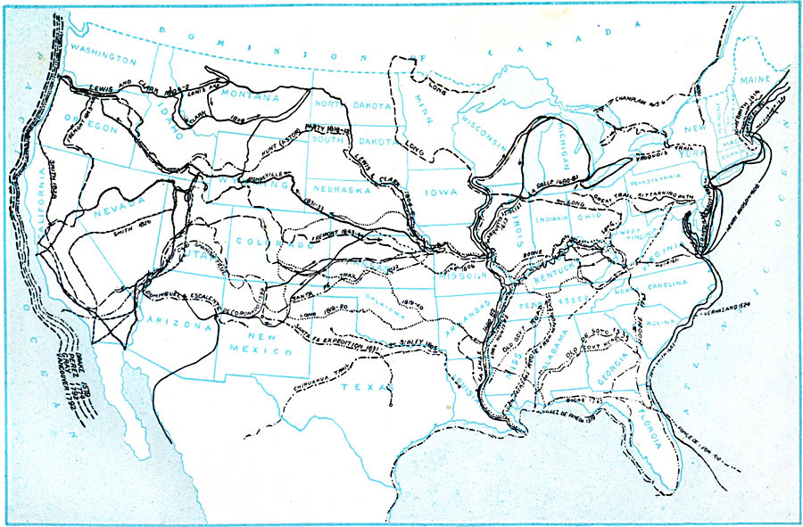
Description: A map of the United States showing the historic sea and land routes taken by famous explorers across North America, from the coastal explorations of Cabot and Corte Real in the Northeast, Ponce de Leon and Alvarez in Florida and the Gulf of Mexico, and the Pacific explorations of Drake, Perez, Gray, and Vancouver, to the continental explorations of La Salle, Lewis and Clark, Fremont, and others.
Place Names: Growth of Nation, Boston, �Chicago, �Houston, �Los Angeles, �Miami, �New Orleans, �New York, �San Diego, �Seattle, �Washington D.C
ISO Topic Categories: location,
oceans,
inlandWaters,
boundaries
Keywords: Westward March of the Great Pioneers and Explorers, historical, �historical event, historical event, location,
oceans,
inlandWaters,
boundaries, Unknown, 1911
Source: John Clark Ridpath , History of the United States from Aboriginal Times to Taft's Administration (vol. 1) (New York, NY: The Review of Reviews Company, 1911)
Map Credit: Courtesy the private collection of Roy Winkelman |
|