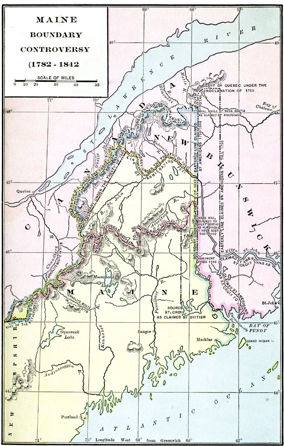
Description: A map of the New Brunswick and Maine region showing the area of boundary dispute between the end of the American Revolution in1782 and the Webster–Ashburton Treaty of 1842. The map shows the various boundary claims during this period, terrain and rivers, the St. Lawrence, and the Bay of Fundy.
Place Names: A Regional Map of North America, Canada, �United State
ISO Topic Categories: boundaries,
inlandWaters,
location,
oceans
Keywords: Maine Boundary Controversy, physical, �political, physical features, country borders, boundaries,
inlandWaters,
location,
oceans, Unknown, 1782–1842
Source: Albert Bushnell Hart, LL.D., The American Nation (New York, NY: Harper and Brothers, 1906) 73
Map Credit: Courtesy the private collection of Roy Winkelman |
|