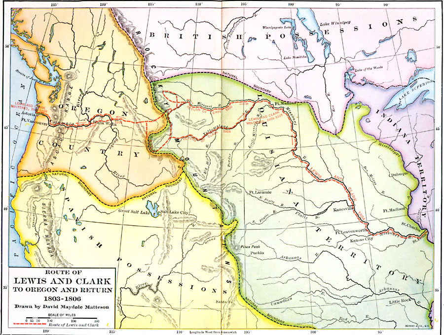
Description: A map showing the route and winter camps of the Lewis and Clark explorations from St. Luis in the Louisiana Territory to Astoria on the Pacific in Oregon Country (1803–1806). The map shows natural boundaries of the British possessions and Louisiana Territory, Oregon Country, and the Spanish possessions to the south of Oregon Country.
Place Names: Growth of Nation, Kansas City, �Astoria, �Salt Lake City, �Louisiana Purchas
ISO Topic Categories: boundaries,
inlandWaters,
location,
oceans,
transportation
Keywords: Route of Lewis and Clark, physical, �political, �transportation, �Lewis and Clark, physical features, country borders,
major political subdivisions, boundaries,
inlandWaters,
location,
oceans,
transportation, Unknown, 1803–1806
Source: Albert Bushnell Hart, LL.D., The American Nation Vol 12 (New York, NY: Harper and Brothers, 1906) 94
Map Credit: Courtesy the private collection of Roy Winkelman |
|