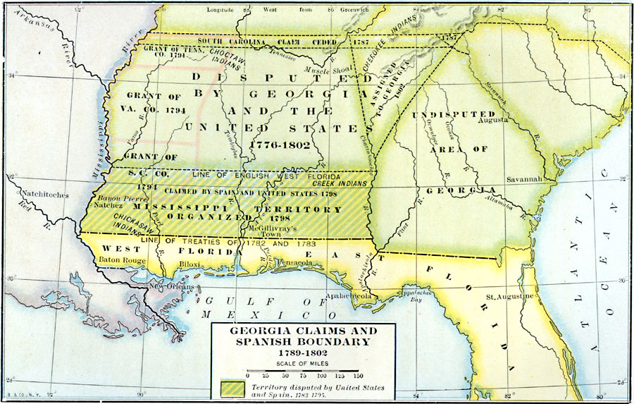
Description: A map of Georgia and Spanish Florida showing the boundaries established and territorial disputes between 1776 and 1802. The map shows the undisputed territory on the Atlantic, the disputed territory by Georgia and the United States between the Chattahoochee River and the Mississippi, the line between English West Florida and Spanish Florida established by the treaties of 1782 and 1783, the South Carolina claim ceded in 1787, the Mississippi Territory organized in 1798 (claimed by Spain and the United States), and the territory assigned Georgia in 1802. The map shows the traditional territories of the Five Civilized Tribes (Cherokee, Chickasaw, Choctaw, Creek, and Seminole).
Place Names: Early America 1400-1800, Savannah, �Augusta, �New Orleans, �Spanis
ISO Topic Categories: boundaries,
inlandWaters,
location,
oceans
Keywords: Georgia Claims and Spanish Boundary, physical, �political, kNativeAmerican, physical features, major political subdivisions, boundaries,
inlandWaters,
location,
oceans, Unknown, 1776–1802
Source: Albert Bushnell Hart, LL.D., The American Nation Vol 11 (New York, NY: Harper and Brothers, 1906) 70
Map Credit: Courtesy the private collection of Roy Winkelman |
|