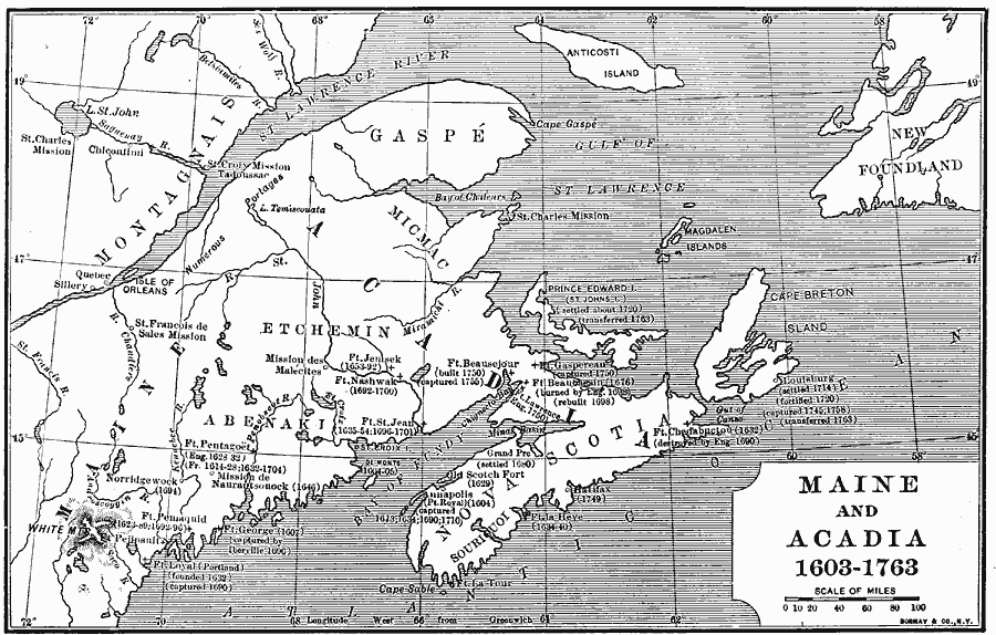
Description: A map of Maine and Acadia showing settlements and forts established between the first settlements in 1603 and the end of the French and Indian War between the French and Britain in 1763. The map shows the dates of establishment and capture during the period.
Place Names: A Regional Map of North America, Canada, �United State
ISO Topic Categories: boundaries,
inlandWaters,
location,
oceans
Keywords: Maine and Acadia, physical, �political, physical features, local jurisdictions, boundaries,
inlandWaters,
location,
oceans, Unknown, 1603–1763
Source: Albert Bushnell Hart, LL.D., The American Nation Vol 7 (New York, NY: Harper and Brothers, 1906) 24
Map Credit: Courtesy the private collection of Roy Winkelman |
|