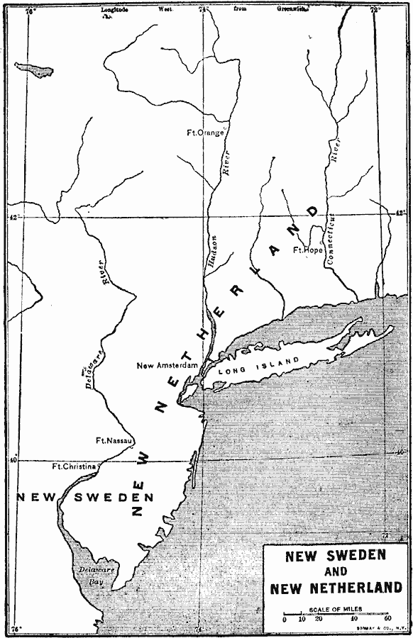
Description: A map of the area from the Delaware Bay to the Connecticut River showing the territory claimed by the Dutch as New Netherlands (1614–1664) and the territory around the Delaware Bay and Delaware River claimed by Sweden as New Sweden (1638–1655). The map shows the Dutch outposts of Fort Orange built in 1624 (previously Fort Nassau on the North River or Hudson, built in 1614, later to become Albany), Fort Hope on the Connecticut River built in 1633 (later becoming Hartford under the English), Fort Nassau on the South River (Delaware River) built in 1623 (later rebuilt across the river as Fort Casimir in 1651 to menace the Swedish settlers in the area), the Dutch settlement of New Amsterdam on Manhattan Island (1623), and the Swedish Fort Christina, the first Swedish settlement in North America, built in 1638 (now Wilmington, Delaware).
Place Names: Early America 1400-1800, New Amsterdam, �Colonial America, �New Sweden, �New Netherlan
ISO Topic Categories: location,
oceans,
inlandWaters
Keywords: New Sweden and New Netherland, physical, physical features, location,
oceans,
inlandWaters, Unknown, 1614–1664
Source: Albert Bushnell Hart, LL.D., The American Nation Vol 4 (New York, NY: Harper and Brothers, 1906) 297
Map Credit: Courtesy the private collection of Roy Winkelman |
|