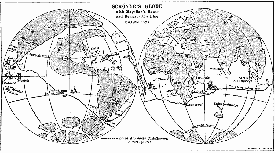
Description: A facsimile from 1906 of the Johannes Schöner Globe, created in 1523. This facsimile shows the North American continent separated from Asia, the route of Magellan's circumnavigation and place of death (1519–1522), and the line of demarcation of Spanish and Portuguese territorial claims established by the Treaty of Tordesillas in 1494 (Linea divisionis Castellanoru e Portugalleii).
Place Names: A Complete Map of Globes and Multi-continent, Africa, �Asia, �Europe, �North America, �South Americ
ISO Topic Categories: transportation,
location,
oceans,
inlandWaters
Keywords: Schöner's Globe, physical, �transportation, kEarlyMapsFacsimile, physical features, water routes, transportation,
location,
oceans,
inlandWaters, Unknown, 1523
Source: Albert Bushnell Hart, LL.D., The American Nation Vol 3 (New York, NY: Harper and Brothers, 1906) 116
Map Credit: Courtesy the private collection of Roy Winkelman |
|