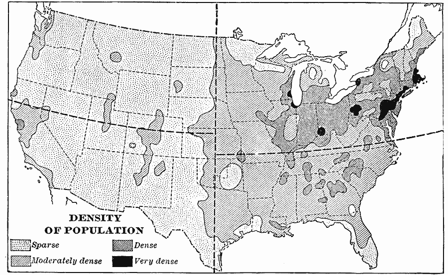
Description: A map from 1901 of the United States showing the population distribution at the time. The map is keyed to show areas of population densities ranging from sparse to very dense. This map is part of a classroom map study illustrating how, if the country were quartered as shown, population density correlates to climate conditions (humid vs. arid)) and topography (plains vs. mountains).
Place Names: Demographics, populatio
ISO Topic Categories: boundaries,
inlandWaters,
oceans,
society
Keywords: Density of Population in the U.S., physical, �political, kPopulation, physical features, major political subdivisions,
country borders, boundaries,
inlandWaters,
oceans,
society, Unknown, 1901
Source: Jacques W. Redway, Natural Advanced Geography (New York, NY: American Book Company, 1901) 57
Map Credit: Courtesy the private collection of Roy Winkelman |
|