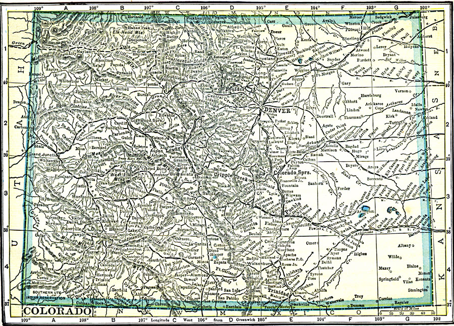
Description: A map from 1909 of Colorado showing the State capital of Denver, major cities and towns, railroads, the Rockies and other mountain systems, lakes, and rivers.
Place Names: Colorado, Boulder, �Colorado Springs, �Cripple Creek, �Denver, �Woody Creek, �Central City, �Leadville
ISO Topic Categories: oceans,
location,
inlandWaters
Keywords: Colorado, historical, �Indian reservations, �local jurisdictions, �political, local jurisdictions, oceans,
location,
inlandWaters, Unknown, 1909
Source: C. S. Hammond, Hammond's Handy Atlas of the World (New York, NY: C. S. Hammond & Company, 1911) 59
Map Credit: Courtesy the private collection of Roy Winkelman |
|