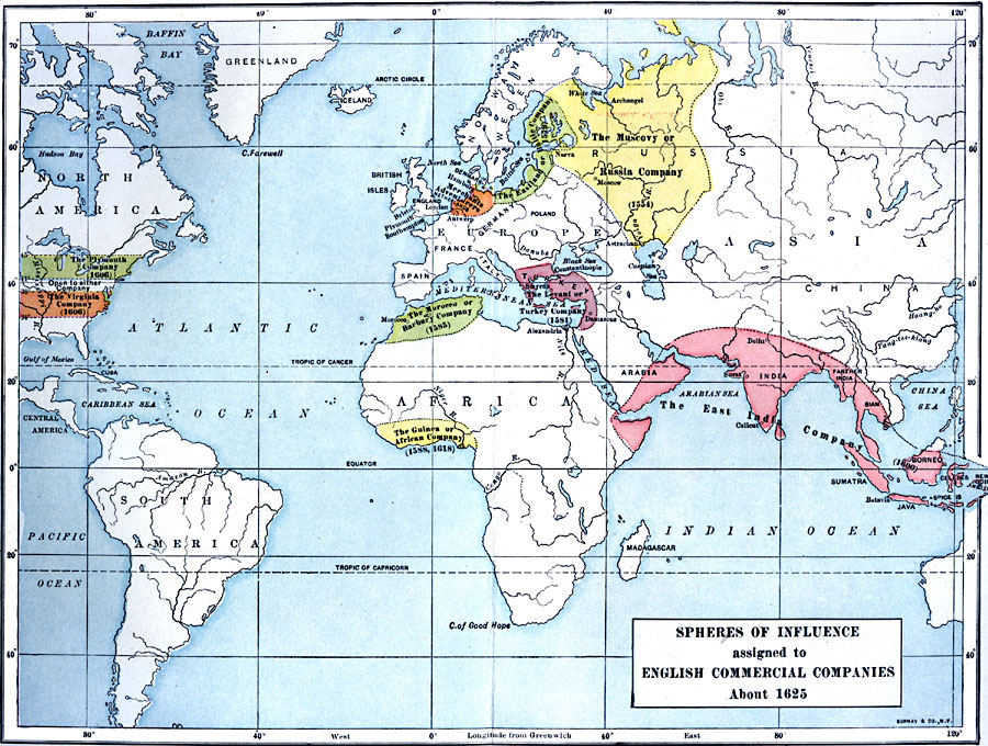
Description: A world map showing the spheres of influence assigned to English commercial companies around 1625. This map is color–coded to show the English enterprises and the territories they controlled, with foundation dates established under Royal Charters, including the Company of Merchants Adventurers (1407), Muscovy or Russia Company (1554), Eastland or Baltic Company (1579), Levant or Turkey Company (1581), Morocco or Barbary Company (1585), East India Company (1600), Plymouth Company (1606), Virginia Company ( 1606), and the Guinea or African Company (1588, 1618).
Place Names: Regional Miscellaneous, Africa, �Asia, �Australia, �Europe, �North America, �South Americ
ISO Topic Categories: physical, �political, �statistical, kWorldEurasia, kWorldEuroAfrica, kWorldAmericas
Keywords: Spheres of Influence assigned to English Comercial Companies, physical, �political, �statistical, physical features, local jurisdictions, economic, physical, �political, �statistical, kWorldEurasia, kWorldEuroAfrica, kWorldAmericas, Unknown, 1625
Source: Albert Bushnell Hart, LL.D., The American Nation Vol 1 (New York, NY: Harper and Brothers, 1906) 122
Map Credit: Courtesy the private collection of Roy Winkelman |
|